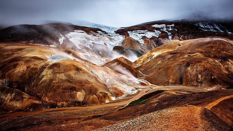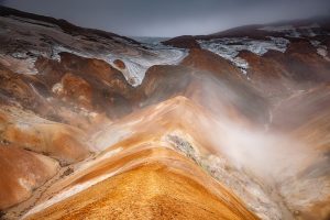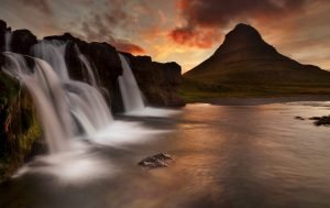
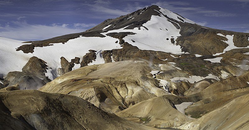
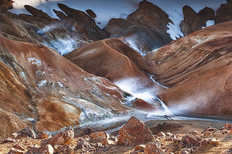
Kerlingarfjöll mountains pop up in the middle of a vast stony plane between two glaciers in the central highlands of Iceland. I put Kerlingarfjöll in the ‘Volcanic’ section because it has a multitude of steam vents and hot springs. The mountain peaks hold ice and snow well into the summer, making Kerlingarfjöll the ice-and-fire mountains. The mountains are believed to have been formed by a twin caldera volcanic eruption.
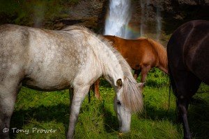
Kerlingarfjöll was formed under a glacier (sub-glacially) during an “ice age” period, although it has erupted since the last ice age as well. The mountain range covers 200 km2 and rises to 1500 meters. The mixture of melt water and hot springs gifts the mountains with grassy areas for camping and horses, at least during the summer.
How to get to Kerlingarfjöll
I thought it was important to include this section early on in this travel guide. To be honest, it is not easy. The longest part of your journey is on the notorious Kjalvegur (F35). If a road number begins with an “F”, it is classified as a mountain road that can only be accessed by 4X4 vehicles. The F35 road is closed during the winter and opens at the end of the thawing season, which is usually late June. The road can remain open well into September, or until the first snow fall.
Kerlingarfjöll can be accessed from either North or South Iceland. From the south, the F35 begins about half an hour north of Gullfoss waterfall. In north Iceland, the F35 is shortly after leaving the ring road between Varmahlíð & Blönduós. The connecting road is 721 which winds over a river and through the valley for a couple of kilometers.
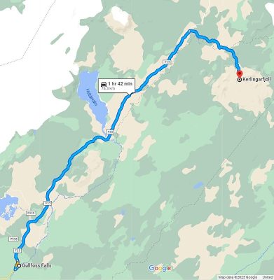
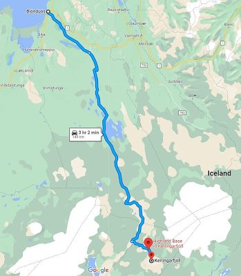
The road that comes off Kalveur into the Kerlingarfjöll mountains is road F347. Kjalvegur is corrugated in places and can become very rough with potholes after a few weeks of being open. If you drive the route after it has been graded, there are no concerns. Otherwise, you have to be very careful to avoid the potholes, which could damage your vehicle and leave you stranded.
Tours to Kerlingarfjöll
Tours to Kerlingarfjöll are rare and highly seasonal. They are expensive because they require 4x4s, and the roads take their toll on the vehicles.
Sponsored
Kjölur Highlands
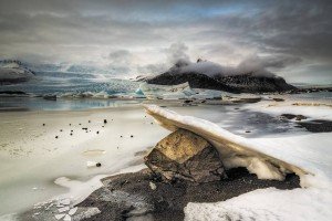
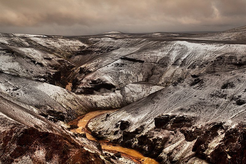
Kjölur is the region that is traversed by the Kalvegur road. It is the area of land between Langjökull and Hofsjökull glaciers. Melt water from the Langjökull glacier feeds the famous Gullfoss waterfall. There are great views of Langjökull from most of the F35 road. Hofsjökull glacier feeds the Pjorsar, which is Iceland’s longest river. This central glacier is 12 km north of Kerlingarfjöll, and can be seen very well from the Kerlingarfjöll mountains.
The Kjölur region is also home to Hveravellir which is about 30 minutes after the Kerlingarfjöll turn-off. Hveravellir is also a geothermal oasis, with grassy areas, steaming vents, hot bathing, and accommodation.
Hiking at Kerlingarfjöll
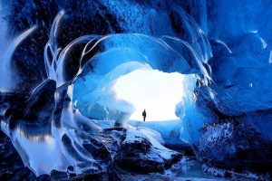
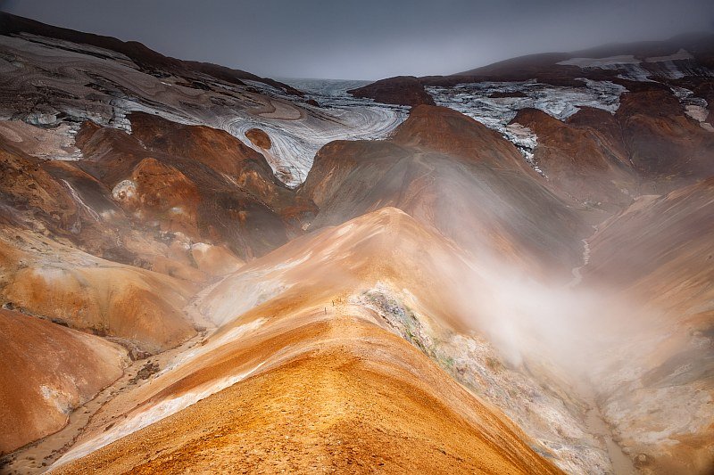
The mountains and valleys at Kerlingarfjöll are laced with many established hiking trails. These are easy to moderate trails that last from a couple of hours to a couple of days. Most of the hiking trails leave from the carpark that is about three kilometers (uphill) after the camping ground and hospitality center. Most of my photos in this Kerlingarfjöll travel guide were taken from near this carpark. Only the top photo involved a short hike. Check out this guide to the hiking routes at Kerlingarfjoll.
Accommodation
Sponsored
Kerlingarfjöll Mountain Resort
Kerlingarfjöll has good camping facilities as well as huts & dorm style accommodation. The huts and campsite can be seen easily from the road winding up the mountains. The resort is seasonal and opens from mid June – September.

Places to Eat
If you are self driving from the south, then is is probably wisest to eat and re-fuel at Geysir. This will be the best choice of food for a while. From the north, there is a good restaurant called “The Pot & Pan” in Blönduós, and there is a decent grill in Varmahlíð.
There are hot meals provided at the Highland Base at Kerlingarfjöll and also at Hveravellir. The choice could be limited to “Soup of the day” or “grilled bacon sandwiches”.
It is wise to have some back-up food & water supplies in case you get stranded.
Blönduós Hotels
These hotels and guesthouses are convenient for connecting to the F35 to Kerlingarfjoll. Blönduós has good restaurants, services and a swimming pool.
Booking.comKerlingarfjöll Photo Tips
I have visited Kerlingarfjöll with the ability to hike and without the ability. You will certainly have a better range of interesting scenery if you hike, but also, the amount of stunning vistas that can be seen from the mountain road is sufficient for most landscape photographers.
Sponsored
Sponsored
Check car hire rates for EuropCar Rental at Keflavik Airport, which is the most convenient way to start your Iceland self-drive.
Probably the best advice for the serious nature photographer is to come around July. If you visit in June, when the Kalvegur road first opens, you will probably be able to reach the campsite, but the road to the rich geothermal zones might not be accessible. In July, there should be access to the upper viewpoints and hiking trails, but there will still be plenty of ice and snow on the mountain peaks.
In my opinion, the interaction of white striations of ice and snow with the steaming red hills is visually striking. In August, most of the snow will be gone. This is good for serious hiking, but the scenery is missing that flash of white, also the roads become terrible in August.