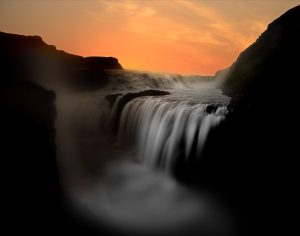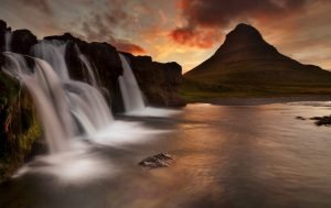
This photo guide to hidden Icelandic waterfalls will introduce you to some well-established waterfalls that are either difficult to find, difficult to access, or hidden until the last minute. This small collection of hidden waterfalls will all involve some adventure and will give you a sense of discovery. If you are in Iceland and there is rainy weather, then having an Icelandic waterfall adventure could save your trip.
Hvernafoss Waterfall
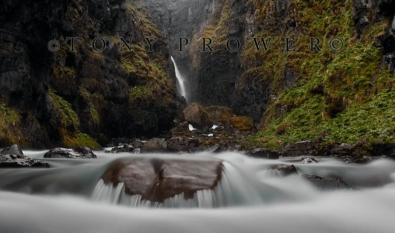
Hvernafoss waterfall is a lesser-known waterfall that is hiking distance from one of Iceland’s most famous Icelandic waterfalls. Hvernafoss is just a healthy walk from Skogafoss on the South Coast. Skogafoss waterfall is not only well known but is also highly visible from Iceland’s #1 highway. Hvernafoss can be seen from the ring road also, but only for a split second. The waterfall is deep in a river gorge.
Private Northern Lights Tours
Directions from Skogafoss
From the Skogafoss road, just continue to the end and turn right. Drive as far as you can; it’s only a couple of hundred meters. There is a fence that separates the museum buildings from a field. Close to the hill, there is a stile, so you can get over the fence and continue on foot. Well, it’s more like a step ladder than a stile. The river gorge is just a few yards away.
There is a rough footpath along the western side of the river, and this is the only way to hike right to the end. The path is quite challenging, and some parts require good balance. At some points, it is difficult to know which path to take. My advice is to always take the high road.
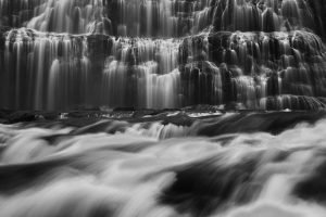
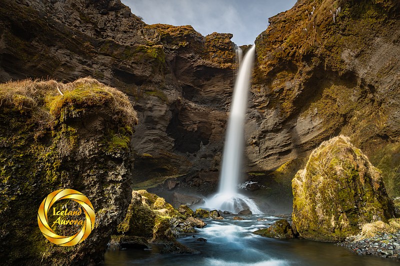
Single Spout
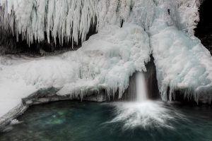
Hvernafoss waterfall is a free-falling single spout of water. It is possible to go behind the falls. This works well with a wide-angle lens, but you have to protect your camera from the constant spray. The waterfall works best with winter light. Around 11 a.m., the sunlight shines right through the river gorge.

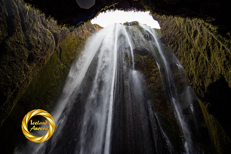
Gljúfrabúi
Gljúfrabúi Waterfall is a real hidden gem near Seljalandsfoss Waterfall. If you have good balance, good walking boots, and waterproofing, Gljúfrabúi is fairly easy to access. There is a campsite at Gljúfrabúi and sufficient parking for visitors. The very top of the waterfall is visible from the Seljalandsfoss access road.
This soaking spectacle can only be seen by either climbing to the top of the canyon (which I never did) or wading through the river into the canyon at ground level. When I say wading, I mean hopping across semi-submerged boulders. It’s like a wet version of steppingstones. In normal shoes, your feet would be soaked before you saw Gljúfrabúi Waterfall.
Getting There
As mentioned above, there is a minor road that connects Gljúfrabúi and Seljalandsfoss Waterfall. So you just drive past Seljalandsfoss until you see car parks on the right. It is also possible to hike to Gljúfrabúi from Seljalandsfoss; just continue over the bridge, and it takes 10 minutes.
Brúarfoss
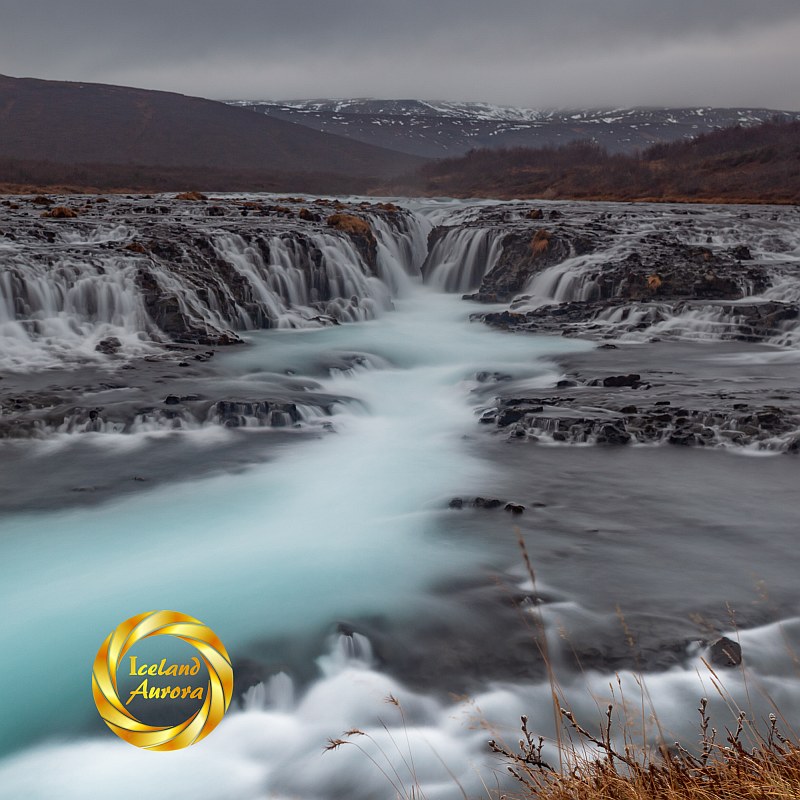
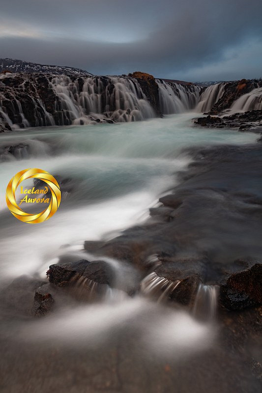
In West Iceland near Laugarvatn is a hidden, but popular waterfall called ‘Brúarfoss’. Bruarfoss Waterfall is an almost symmetrical complex of delicate cascades which lead into a blue river. The famous waterfall only works after rainfall. It is pointless visiting Bruarfoss Waterfall when it hasn’t rained for a while.
‘Bruarfoss’ means ‘Bridge Falls’. Indeed there is a bridge at Brúarfoss Waterfall. This view point is common for most photographers. Despite being advise to take my photo from the bridge, I wanted a natural foreground, so took this just to the right of the bridge.
Difficult Access
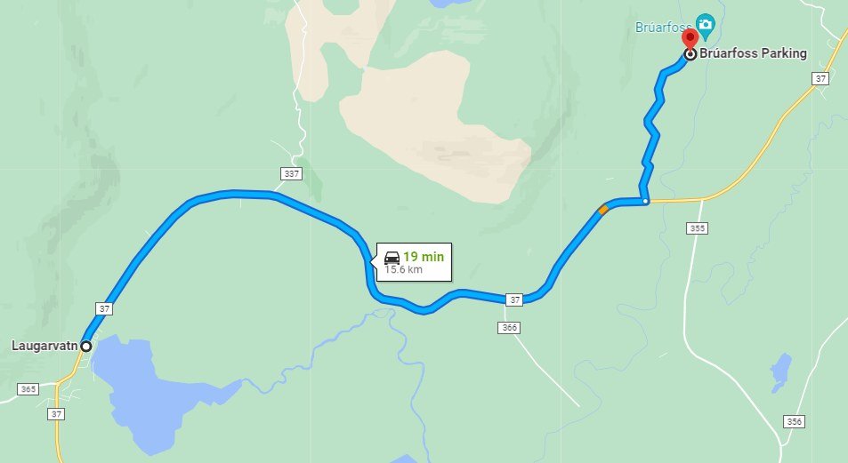
Bruarfoss Waterfall used to be difficult to find because you had to drive through a Summer House estate and park unofficially. It took about 10 minutes to hike to the waterfall from the Summer Houses. When tourists invaded in large numbers, they closed access to the Summer Homes and set up a car park near the main highway (#37). The car park is next to the river, so the new hike to access Bruarfoss Waterfall is an hour’s hike along the river.
Wet Feet
As mentioned above, the waterfall is best after rain. The surrounding area can be very wet after rain. I strongly recommend high boots or Wellingtons.
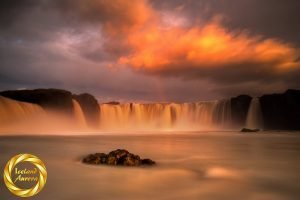
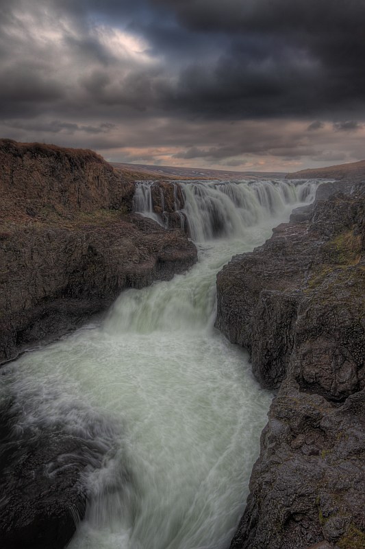
Fagrifoss
Fagrifoss Waterfall can be found on the rough trail from Fjaðrárgljúfur canyon to Lakigigja Craters. It is about 20 miles from Kirkjubaerklaustur. The road (F206) is quite challenging and involves crossing rivers. The last river you cross before Fagrifoss Waterfall is the river Geirlandsá, which runs over the waterfall into the valley below. Sometimes the river is very shallow, and you can walk to the top of the waterfall.
There is a viewing platform opposite the falls and it is possible to get down to the river.
Urriðafoss
Urriðafoss is one of many significant waterfalls on the Þjórsá River. Þjórsá is the longest river in Iceland (230 km) and has the highest volume of water in Iceland. Urriðafossis spread out into an area the size of a football field. There are a few levels of small cascades and rapids. The river is very foreboding at this point. The name denotes a salmon waterfall and this Icelandic waterfall is one of many waterfalls traversed by the salmon in the Autumn.
Getting There
The waterfall has its own carpark and is only one kilometer from the #1 Ring Road. If you are traveling east, the right turn for Urriðafoss is just before a major bridge between Sellfoss and Hella in South Iceland. Just before you get to the turning you will see an old iron bridge on the left.
Glymur
How is this for ‘Hidden’? This is as much as I ever saw of Glymur waterfall. It is possible to see more of the really tall waterfall from the top of the gorge. However, I always have to do things differently, so this was my second attempt of wading up the river through the gorge. The river current is very strong, so this was as far as I got both times.
Glymur was the tallest Icelandic waterfall until calving glacier ice exposed a taller waterfall in Morsárdalur called Morsárfoss. I was in Morsárdalur before the calving, so I haven’t seen the new waterfall.
Finding Glymur
Drive North from Reykjavik on the ring road. Before you get to the tunnel, there is a road on the left which goes around Hvalfjordur – the whaling fjord. At the very deepest point of the Fjord there is a small track to a car park. There are signs denoting the hiking path to Glymur waterfall. The path forks with a choice of going up-hill or staying at ground level. Follow the path up-hill if you want to see more of Glymur than I did. Or head down to the river canyon for something different.
Kolufoss
Kolufoss waterfall falls into Kolugljúfur – a river Canyon in North Iceland. The waterfall is part of the Víðidalsá river. The river gorge is said to have been carved out by a female Troll (Kola) who loved salmon. She loved salmon so much that she carved out her home in the river. According to Icelandic folklore, Kola cast a spell to protect the canyon.
Directions
Kolufoss waterfall is not easy to find, you have to drive several miles on unpaved roads past several horse farms. See the Map below.
Booking.com